


| Location: | between Balashi and Pos Chiquito |
| Year Built: | 1929 – 30 |
| Status: | Not protected |
| Category: | Infrastructural heritage |
Spanish Lagoon Bridge * 1930
Category: Other Districts
Until about a century ago, connections with the south-east side of the island were limited to an unpaved road passing through the Frenchman’s Pass, Rooi Frances.
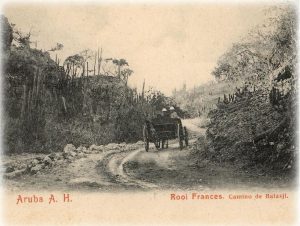
It took travelers almost a day to get to the other side of the island, depending on the weather. Rain and mud could hamper the trip, which was often made in a ‘kitrien‘, a horse-drawn carriage shown in the picture above taken in 1903. There would be occasions that travelers even had to stay overnight in Savaneta before reaching San Nicolas.
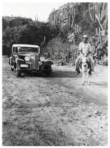
By the end of Aruba’s ‘Roaring Twenties’ (with the establishment of two oil refineries), a new coastal road was built, linking Oranjestad directly to Savaneta and San Nicolas and beyond, the Lago Oil Refinery and Lago Colony.
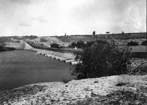
An important obstacle had to be crossed: the water inlet called Spanish Lagoon. Not a single bridge existed at the time, but Aruba’s Lieutenant Governor, Isaac Wagemaker, who had been looking for the best spot to cross the lagoon, decided not to build a real bridge, but a low dam in which 12 huge pipes, just around the sea water level, to let the water through from one side to the other.
The picture from 1929 shows the ‘bridge’ under construction.
Once completed in 1930, the crossing caused a huge reduction in travel time by automobile from the capital ‘Playa’ to the booming oil village of San Nicolas and to the Lago refinery and vice versa, of course.
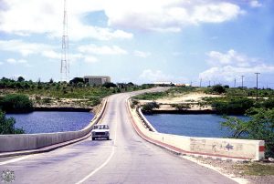
The Spanish Lagoon bridge divides the island in two fictional halves, in Papiamento known as p’abou di brug (beneath the bridge) and p’ariba di brug ( above the bridge), indicating the Playa side and the San Nicolas side. Pictures above and below are from 1964.
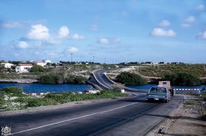
The bridge became one of the island’s most important landmarks and a unique piece of infrastructural heritage. Commuters between the island’s two major cities use it daily.
A big overhaul to the bridge was undertaken in 2010/11; new pipes were installed underneath and the level of the road was slightly raised. It remained as narrow as it had always been, however.